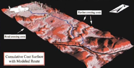
The Norfolk Southern Railroad Corporation employed the services of the Affiliated Research Center (ARC), a NASA sponsored data collection agency located on the University of South Carolina. This group was asked the cheaply and efficiently map the most optimal route for their new train lines. ARC employed LiDAR (Light Detection and Ranging) technology to 3 dimensionally map the land and determine the best routes. The “best” routes would be determined by construction costs, taking in to account amount of straight rails, amount of excavation or bridges needed to be made, and length of track.
The LiDAR technology is a remote-sensing technique used to accurately map topography. LiDAR can encounter issues when it detects tree canopies and power-lines. ARC has developed a canopy removal algorithm in order to comensate for this issue.

